
Description
Xaisomboun (also Saysomboun, /saɪʒəʊmbuːn/ Lao ໄຊສົມບູນ) was a special zone (khetphiset) of Laos, located in the north of the country, near the capital Vientiane. The special zone was created 1994 with area split off from the provinces Vientiane, and Xiangkhoang. It was dissolved on January 13, 2006. Established as a province on 13 December 2013.
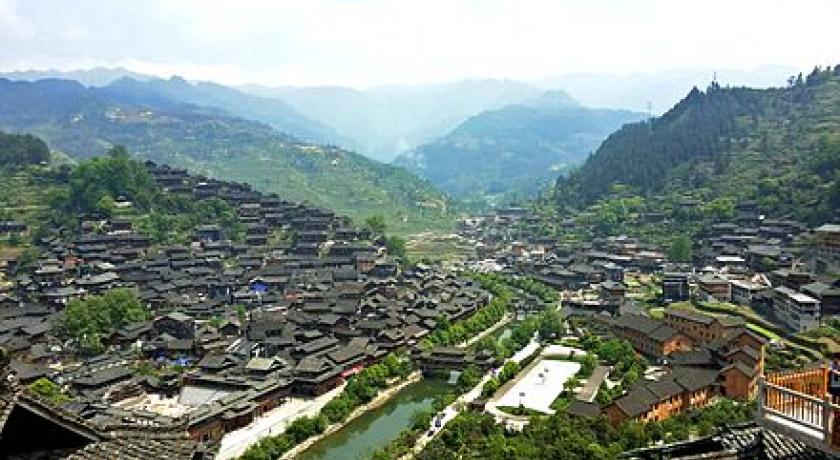
The Province consists of 5 districts which include Anouvong, Long Cheng, Long San, Hom and Tha Thom District. The total population is around 80,000 with Hmong the majority of its people. This province does not share any borders with neighboring countries.
Xaysomboun Province has abundant natural resources scattered in high mountains and steep valleys. Due to this contour, the climate in Xaysomboun is pretty cool with the annual average temperature of approximately 20˚C. Furthermore, this province has rich culture and tradition coupled with generous hospitality of local people.
Demographics
Population: 12,065 families; 82,000 people (women: 39,070)
Tribes: Hmong 55.71%; Laoloum 25.97%; Khmu 18.32%
Geography
- Area: 8,300 km2
- Temperature: cool (15 °C - 26 °C)
- Humidity: 77%
Access to the province from Vientiane, the national capital, is via South 13 Road to Bolikhamxay Province, thence via Thaphabath District and Laongxan District.
History
Xaisomboun is the 18th province of Lao PDR. It was known as a special administrative zone between 1994 and 2006, and established as a province on 13 December 2013.
Meaning of 'Xaisomboun' is 'Perfect Victory' (of Lao People's Revolutionary Party over America in 1970s)
Protected areas
Phou Khao Khouay National Biodiversity Conservation Area is a protected area located 40 kilometres (25 mi) northeast of Vientiane. It was established on 29 October 1993 covering an area of 2,000 km2 extending into Xaisomboun Province, Vientiane Prefecture, Vientiane Province, and Bolikhamxay Province. Its mountainous topography, with elevation varying from 200 m – 1761 m, emerged from "uplifting and exposure of the underlying sedimentary (Indosinias schist-clay-sandstone) complex". Sandstones are also seen spread in layers. Extensive Flat uplands with sandstones with hardly any soil cover are also part of the topography of the park. It has a large stretch of mountain range with sandstone cliffs, river gorges and three large rivers with tributaries which flow into the Mekong River. It has monsoonal climate with recorded annual rainfall of 1936.1 mm (with higher reaches recording more rainfall). The mean annual temperature is 26.6 °C with recorded the mean maximum of 31.6 °C and the mean minimum temperature of 21.5 °C. The forests are evergreen, Shorea mixed deciduous forest, dry dipterocarp and pine type; particularly coniferous forest, of mono specific stands of Pinus merkusii, Fokienia hodgsonsii, bamboo (mai sanod), and fire-climax grasslands. Animals found here include elephants, tigers, bears, 13 pairs of white-cheeked gibbons, and langurs and many species of reptiles, amphibians and birds. The green peafowl has been reported here, near Ban Nakhay and Ban Nakhan Thoung, although it was generally considered to be extinct in Laos; conservation management has increased its population.
Attractions
Chao Anouvong Caves are located in Phouhuaxang Village, about 4 kilometers north of Anouvong town. This area is surrounded by a number of mountains and Nam Jang River flows through the caves. There are two caves located close to each other; one is 7 meters high, 4 meters wide and 30 meters long; the other is 3.5 meters high, 5 meters wide and 300 meters long. The second cave has an interesting history as it has been told that King Anouvong stayed there in order to hide himself from Siamese army. In spite of a small force of King Anouvong, he eventually succeeded to escape and set up his strong hold at the river bank of Nam Jang or recently called “Nam Ja”.
Long Cheng Temple
The temple was built in 1966 by the wife of General Vang Pao. It is the oldest temple in Long Cheng District. There is a sacred Buddha image in the temple. People come to worship and pray for their prosperity and good fortune.
Tad Houay Nok (Houay Nok Waterfall)
Tad Houay Nok is near Kongkhao Mountain soaring between Nam Mo and Thong Hak Village. It is about 30 kilometers far from Anouvong town. The waterfall is 200 meters high and the water flows all year round. On holidays, particularly during Pi Mai Lao (Lao New Year), many people choose Tad Huay Nok as their destination for water recreation. Besides, they can also enjoy visiting nearby local farms growing sugarcane, banana and Aquilaria Crassna.
Tad Poung Waterfall
It is situated in Ban Nam Khui Village, about 8 kilometers far from Long San Village. It is 18 meters high cascading 10 meters and 8 meters high respectively. The area is surrounded by wonderful nature, mountains, green forest and fresh cool air.
Tad Pha Chae Lae Waterfall
The waterfall is 100 meters high. It is situated at Ban Nam Khien Village in Hom District. It is about 6 kilometers far from Hom district. The water flows all year round. The area is surrounded by various species of trees with cool fresh air.
Tad Gnong Waterfall
It is situated at Ban Pak Gnong Protected Area in Tha Thom District; about 2 kilometers far from Tha Thom District on the route number 1D. The waterfall is 30 meters high and the water flows all year round. This area is rich in biological species and rare wildlife.
Nam Ngum Dam II
Nam Ngum Dam II is a huge reservoir located 35 kilometers south of Anouvong town. It was built for generating hydroelectric power and agriculture purpose. The dam has become a populous tourist attraction in Xaysomboun Province because of the spectacular view of the reservoir and cold weather along Nam Ngum River. There are two access routes; one is from T-junction at Huay Mor, Vang Vieng District to Km 24 Village’s Port and the other is from T-junction at Nam Yorn Village to Na Tou Port.
Phou Mork (Mork Mountain)
Phou Mork is located not very far from Long Cheng Village where you can relax in the fresh air. In the early morning, you will see the whole mountain covered by thick mist that is well-known as “sea cloud” or “heaven on earth”. This charming spot attracts many visitors for captivating atmosphere of the mountain.
Phou Bia Mountain
Phou Bia is the highest (2,820 meters) mountain in Laos, situated in Anouvong District, 30 kilometers north of province’s capital. The annual average temperature on the top of Phou Bia is approximately - 5˚C. This area is rich in biodiversity, providing a home for various species of wildlife. Interestingly, there is a special type of grasses resembles a pile of straw covering throughout the ground, and we will feel smooth when we step on it. Apart from that, thousands of priceless trees such as Mai Long Leng (Fokienia Hodginsii) are also standing along the valley of the mountain. The climate is fresh, humid and cold throughout the year which makes this area more attractive and suitable for relaxation, especially for those who would like to experience cold weather.
Dan Pha Saeb Cliff
It is located about 18 kilometers north of Long San Village. There is a wonderful waterfall that is 20 meters high and 30 meters-40 meters wide. The cliff has two levels, cascading 10 meters high each. The water runs under the ground on the first level and the waterfall is on the second level spotted with giant beehives.
The Palace of King Sisavang Watthana
The palace was built in 1967 by King Sisavang Watthana. It was built to accommodate his Royal family during their vacation, especially in dry season. After declaring the independence of Laos in 1975 it was renovated and become a museum, welcoming visitors on official working days.
Stay Safe: There has been some unrest in this area in the past. It’s always a good idea to get advice before travelling.
Source https://en.wikipedia.org/wiki/Xaisomboun_Province
http://www.tourismlaos.org/search.php
Address
Xaisomboun Province
Laos
Lat: 18.898551941 - Lng: 103.081329346

