
Description
Sai Kung District
Sai Kung District is the second largest district in Hong Kong in terms of area. It comprises the southern half of Sai Kung Peninsula and Clear Water Bay Peninsula in the New Territories plus a strip to the east of Kowloon. It is made up of the Sai Kung Town, Sai Kung rural areas, Tseung Kwan O New Town and over 70 islands of different sizes. The administrative centre is Sai Kung Town but the district's population is concentrated in Tseung Kwan O. The district has the second youngest residents. Known as the "back garden of Hong Kong", Sai Kung has been able to retain its natural scenery, and where the Hong Kong Global Geopark is located. Behind the modern buildings, a lot of traditional customs and cultures are still retained in the rural villages.
Population and settlement
Sai Kung District covers approximately 136 square kilometres (53 sq mi) and as of 2006, it had a population of 406,442 in 2006, most of it in Tseung Kwan O.
Sai Kung Town
As a former fishing village, Sai Kung Town is a mecca for seafood lovers, locals and tourists alike. The designation of the country park areas during the 1970s was a huge boost to the local tourist industry. Sai Kung town underwent significant expansion during the 1970s when the High Island Reservoir and associated water scheme required some villagers and fishermen to be rehoused in Sai Kung. This provided a core of government-funded new development, both housing and commercial, in the town centre. This was followed by the Tui Min Hoi (literally 'over the harbour') development under the government's market town programme. Visitors can stroll around the regional market centre of Sai Kung Town or explore the back lanes, visit the Tin Hau Temple, feast on seafood or enjoy diverse delicacies at both Eastern and Western-style pubs and restaurants. There is also a famous dessert restaurant called Honeymoon Dessert that brings in many visitors from all over Hong Kong and even from abroad.
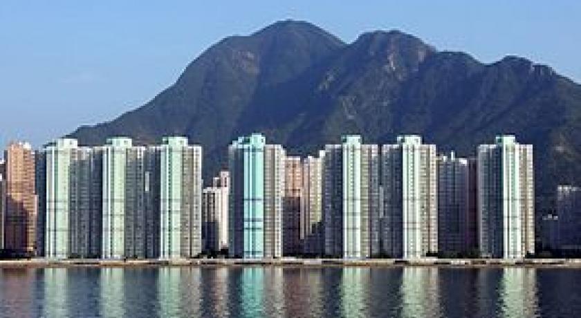
Tseung Kwan O
In addition to Sai Kung, Tseung Kwan O or Junk Bay, a booming new town, is also part of Sai Kung District. Tseung Kwan O connects Sai Kung Peninsula with the Kowloon urban area.
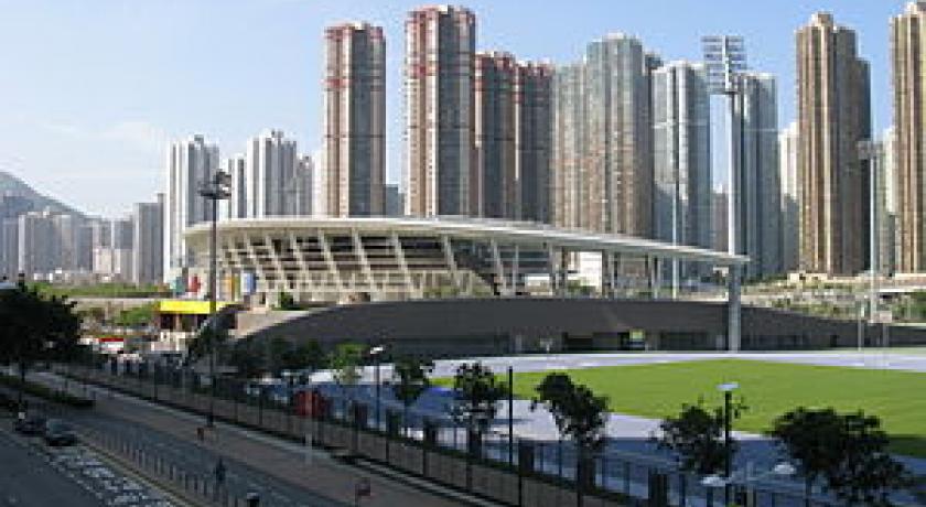
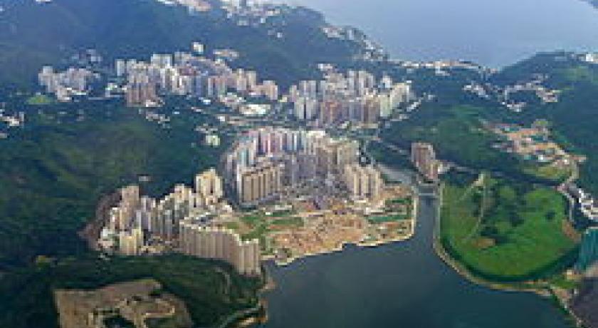
Junk Bay was once a natural bay area in Sai Kung, quite near the famous seafood village of Lei Yue Mun. There once was an iron and steel factory, and the area around Hang Hau Village was famous for the shipyards. In 1997, the Hong Kong Government started a major development project in this area, developing it into the seventh Hong Kong new town. Reclamation has since covered the whole bay area and it is now able to accommodate around 380,000 inhabitants, accounting for 95% of the district's total population. This new town was renamed Tseung Kwan O, its present name.
Tseung Kwan O now includes several high-rise residential estates and an industrial estate. The MTR metro system was extended to Tseung Kwan O, facilitating access to Sai Kung District.
Geography
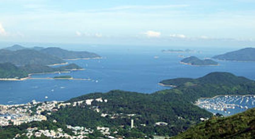
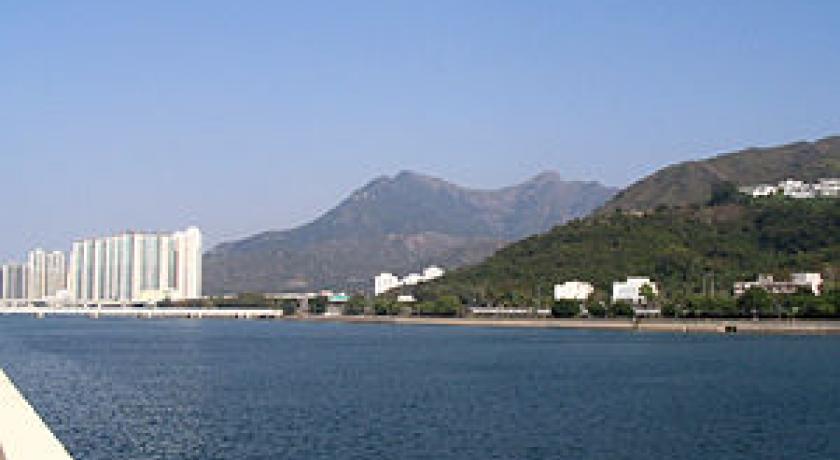
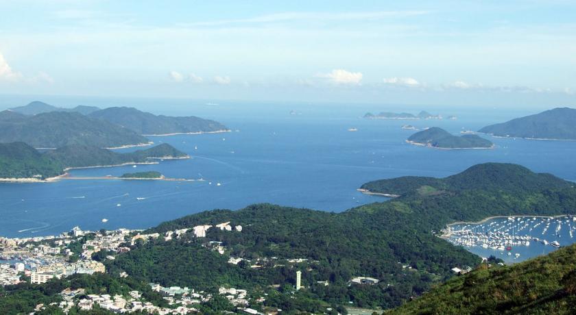
In contrast to the densely populated areas of Hong Kong Island and Kowloon, Sai Kung District's heartland is a coastal area characterised by beautiful scenery, charming small villages and stunning seascapes. The area is known for its pristine beaches and quiet living. Inasmuch as it remains only partly urbanised, Sai Kung is known as the "last back garden" of Hong Kong.
UNESCO Global Geopark & Country ParksBeaches
Po Pin Chau, a stack island near the High Island Reservoir East Dam
- Sai Kung Volcanic Rock Region, Hong Kong UNESCO Global Geopark
Sai Kung Volcanic Rock Region lie Sharp Island, High Island, the Ninepin Group and the Ung Kong Group (Wang Chau, Basalt Island and Bluff Island), where volcanic rocks, intrusive rocks and world-unique acidic hexagonal volcanic columnar rock joints created by Hong Kong's last large-scale volcanic activity some 16.5 million to 14 million years ago crop out. Together with a host of volcanic rock coastal landforms, form a comprehensive showcase of diverse and complex volcanic activities that explain Sai Kung's geological past.
- Sai Kung East Country Park
Sai Kung East Country Parkoccupies a vast area of east Sai Kung Peninsula. With the High Island Reservoir, High Island, Tai Long Wan, Pak Tam Au, Chek Keng, Sheung Yiu, Wong Shek Pier and the surrounding countryside, the 4,494 hectare protected area consists of the largest number of bays and coves among all country parks in Hong Kong. Part of the Geopark is also located there.
- Sai Kung West Country Park
Sai Kung East Country Park, including the Sai Kung West Country Park (Wan Tsai Extension), occupies a vast area of west Sai Kung Peninsula. Old preserved villages, such as Pak Sha O, Yung Shue O and Lai Chi Chong are the places of interest in this country park.
- Clearwater Bay Country Park
Clear water Bay Country Park occupies the rugged terrain around High Junk Peak, located in the eastern and the western part of the Clearwater Bay Peninsula. High Junk Peak, one of the four treacherous peaks in Hong Kong - is the no. 1 attraction of the Country Park.
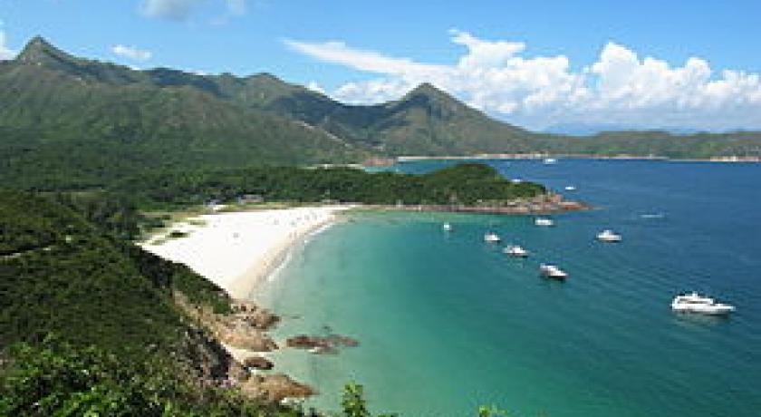
Beaches
Sai Kung has some of the most beautiful and cleanest beaches in Hong Kong. Here is a list of the beaches in Sai Kung:
- Clear Water Bay 1st Beach
- Clear Water Bay 2nd Beach
- Silverstrand Beach
- Tai Long Wan (Big Wave Bay)
Tai Long Wan (Big Wave Bay), approximately 1.5 hours walk from the nearest road, is one of the few places in Hong Kong where surfing is possible, particularly in the winter months.
- Long Ke Wan
Islands
On summer nights, a lot of people hire small boats known as kaitos or sampan, some to catch cuttle-fish which is a popular pastime for local residents, others for leisurely trips through the island-dotted inland sea of Port Shelter. Popular islands to visit include:
- Kau Sai Chau
- Kiu Tsui Chau (Sharp Island)
- Leung Shuen Wan Chau (High Island)
- Pak Sha Chau (White Sand Island)
- Yeung Chau (Sheep Island)
- Yim Tin Tsai (Little Salt Field)
The large island of Kau Sai Chau is the location for a public golf course developed and run by the Hong Kong Jockey Club.
Address
Sai Kung District
Hong Kong
Lat: 22.383388519 - Lng: 114.270973206

