
Description
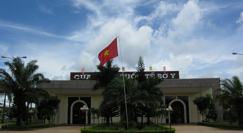
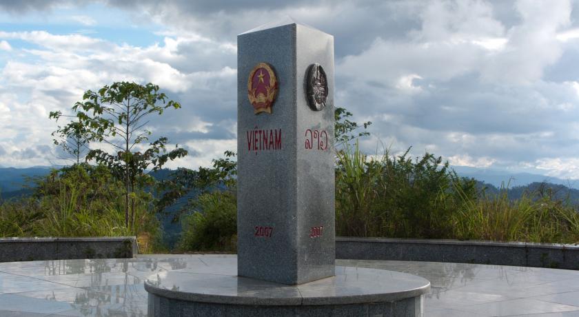
Kon Tum Province lies in the Central Highlands region of Vietnam and shares borders with Laos and Cambodia.
The economy is primarily agricultural.
Demographics
According to the 2009 census the recorded population was 430, 133, covering an area of 9, 690 km2, giving a population density of 51.2 inhabitants per km2.
The official estimated population for 2015 was 495, 900 inhabitants.
Ethnicities : Kinh, Xo Dang, Ba Na, Gie Trieng, Ra Glai
Toponymy
The name Kon Tum comes from the name of a village of the Bahnar ethnic group. In the Bahnar language, kon means "village" and tum means "pool". Prior to the adoption of the Vietnamese alphabet in the 1920s, the name was rendered as 崑嵩.
Administrative divisions
Kon Tum is subdivided into 9 district-level sub-divisions:
- 8 districts:
- Đắk Glei
- Đắk Hà
- Đắk Tô
- Kon Plông
- Kon Rẫy
- Ngọc Hồi
- Sa Thầy
- Tu Mơ Rô
- 1 provincial city:
- Kon Tum (capital)
They are further subdivided into 6 commune-level towns (or townlets), 83 communes, and 10 wards.
Geography
The remote Kon Tum province is located in the northernmost region of Vietnam’s Central Highland. It shares the common border with Laos, Cambodia on the west, with Quang Nam province on the North, Quang Ngai province on the east and Gia Lai province on the south. The capital city is Kon Tum.
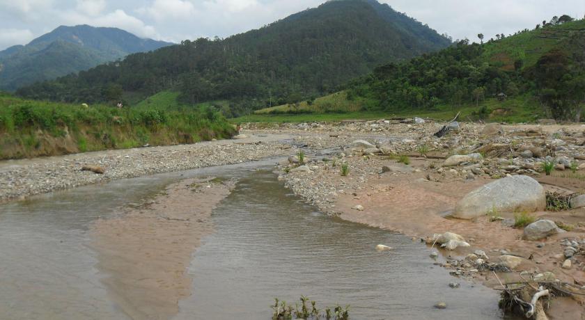
In the north is the highest granite mountain region in Southern Viet Nam with Ngok Linh 2,598m and Ngoc Phan 2,251m. It is the source of the, Tranh, Thu Bon, Tra Khuc and Ba rivers.
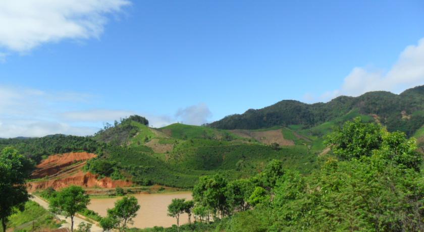
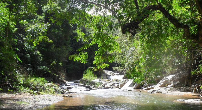
Forest covers 50% total of Kontum area with valuable wood, rare plants and birds. Basalt soil is suitable to plant rubber, coffee, tea and sugar cane. The province has 26,000ha grassland that gives good condition to raise cattle.
Topography
The common topographical features of Kon Tum are of the highland type. This province is west of the Truong Son Mountain range, slopping from north to south and from east to west. The terrain is very steep in the north, with the height in this area varying from 800–1,200m, and the height on the southern side is from 500–530m. Ngoc Linh Mountain is the highest of the province at 2,600m.
Climate
Kontum has feature climate of Central Highland. That is tropical monsoon one. The temperature, with a range of 20–24oC, is lowest in January and the highest in April and May. The difference between the lowest and highest is a mere 6–7oC. The rainy season is from April to October and the dry season is from November to March.
History
Battle of Kontum
The lead-up to the Battle of Kontum began in mid-1971, when North Vietnam decided that its victory in Operation Lam Son 719 indicated that the time had come for large-scale conventional offensives that could end the war quickly. The resulting offensive, planned for the spring of 1972, would be known as the Easter Offensive in the South and the Nguyen Hue Offensive in the North, Nguyen Hue being a hero of Vietnamese resistance against the Chinese in 1789. The Easter Offensive would make use of fourteen divisions and would be the largest in the war.
The 1972 Easter Offensive/Nguyen Hue Campaign began with a massive attack on the Demilitarized Zone with 30,000 People's Army of Vietnam (PAVN) soldiers and more than 100 tanks. Two thrusts of equivalent size, one towards Saigon and a third to the Central Highlands and provincial capital of Kontum began soon after. The North Vietnamese knew that if they could capture Kontum and the Central Highlands, they would cut South Vietnam in half.
The Battle for Kontum would pit the Army of the Republic of Vietnam (ARVN) 22nd and (later) the 23rd Divisions under the command of Lt. Gen. Ngo Dzu and later Maj. Gen. Nguyen Van Toan against the equivalent of three North Vietnamese Army divisions, the 320th and 2nd Divisions plus combat units of the 3rd Division, B-3 Front, and local Viet Cong forces under the command of Lt. Gen. Hoang Minh Thao.
Background
North Vietnam had been using the Ho Chi Minh Trail along the border as a logistical artery for years. The mountainous terrain and the jungle were a shield against American air attack.
The ARVN bases at Tân Cảnh and Đắk Tô, were protected by the 42nd Regiment of the 22nd Division. The 22nd also controlled five fire support bases (FSBs) that stretched south-west from Tan Canh towards Kontum along a backbone of mountains nicknamed Rocket Ridge.
Attacks on the Fire Support Bases
On the morning of April 4, 1972, an early morning attack was launched against Firebase Delta. The attacks on the FSBs continued as April wore on. Finally on April 21, FSB Delta was taken by the PAVN. Several of the other bases had to be given up soon after with heavy casualties.
On 25 April the PAVN mopped up the remaining ARVN positions around Tân Cảnh/Đắk Tô. With the loss of the main camps, the remaining firebases along Rocket Ridge were abandoned and the PAVN had a clear approach to Kon Tum.
With the loss of Tan Canh, little stood between the PAVN and Kontum. Whether because of logistical issues or lack of leadership, the PAVN did not pursue their advantage. Instead of refilling their tanks and traveling 25 miles to Kontum, the North Vietnamese waited for almost three weeks.
In early May the PAVN turned their attention to the Polei Kleng Camp which blocked the avenue for attack on Kontum and to Ben Het Camp which threatened their supply lines. The ARVN continued to hold for a further 3 days during which time U.S. airpower, including 16 B-52 strikes, was concentrated on the attacking PAVN. On the morning of 9 May the ARVN abandoned the base in the face of a PAVN tank and infantry assault.
The PAVN attacked Kontum without the heavy artillery preparation that had been used at Tan Canh and drove straight down Route 14. The 48th PAVN Regiment and 203rd Tank Regiment attacked the city from the northwest. The 28th PAVN Regiment came from the north and the 64th and 141st PAVN Regiments attacked from the south.
The sky was overcast and tactical air support was not able to operate. However, Hawk's Claw had arrived on the scene from Camp Holloway. Their helicopters and Jeeps had BGM-71 TOW missiles, which were powerful enough to penetrate a T-54. They found the PAVN tanks before they could find cover in the jungle and destroyed two more tanks. By 09:00 hours, the attack had been stopped.
The battle see-sawed back and forth on 28 May. The PAVN occupied bunkers and buildings in sections of the city and were too well fortified to be destroyed by air or artillery attacks. However, their ability to launch a sustained attack seemed to be gone. With US and VNAF air superiority, PAVN troops could not receiving adequate food and supplies from their bases in the jungle.
In June 6, the PAVN's B3 Front Command mobilized their last reserve unit, the 66th Regiment to cover the withdrawal of all remaining within the town.
From May 29 to June 8 the ARVN forces went bunker to bunker cleaning out the remaining PAVN forces. On June 9 the city of Kontum was declared fully secure by the 23rd ARVN Division Commander, Ly Tong Ba, who had been promoted to Brigadier General. The combined efforts of the ARVN troops and US aviation units had finally stopped the massive assault.
The Battle of Kontum, a key success during this period, was virtually ignored in the US. The victory was written off simply as an example of B-52 power. Certainly the hundreds of missions between February and June were a major element of the success. But the PAVN had neutralized this advantage in large part by using the jungle and attacking at night.
Tourism
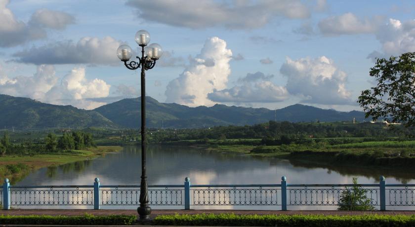
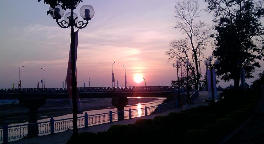
Compared to other provinces such as Lam Dong (with Dalat), Kon Tum attracts relatively few travelers since it is quite mountainous. Its provincial capital is Kon Tum town, which is situated on the bank of Dakbla River. Kon Tum is featured with the majestic mountainous landscape and several tourist attractions such as Ngok Linh Mountain, Chu Mon Ray Primitive Forest, Dak Tre Tourist Site, and Dak To Ho Spring. Besides, there are historical relics namely Kontum Former Prison, Dak Glei Prison, Ho Chi Minh Trail, Dak To, Tan Canh Battle Field. Coming to Kon Tum, many tourists are impressed by the wooden stilt houses in Ba Na village and Communal House (Nha Rong), which can be found nowhere else.
Culture
Kontum has colorful, diversified culture of ethnic groups. Their customs are unique with special traditional festivals like cong chieng (gongs), buffalo stabling, leaving- the- tomb, new rice festivals. Among them, cong chieng culture is the pride of Central Highlands’ People because it was recognized as a Masterpiece of the Oral and Intangible Cultural Heritage of Humanity (November 25, 2005) by UNESCO. Gongs and gong culture present a means to affirm the community and its cultural identities. The cultural space of Tay Nguyen gong spreads over five provinces, including Kon Tum, Gia Lai, Dak Lak, Dak Nong and Lam Dong and the masters of gong culture are the ethnic groups, including Ba Na, Xe Dang, M’nong, Ede and Gia Rai.
One special festival can be found in Kontum is Village Land Praying Ceremony (end of the 2nd and beginning of the 3rd lunar month). This is a festival of the Ba Na people who live in Kontum and Gia Lai. Ba Na villagers hold the Village Land Praying Ceremony in preparation for the new crop or moving to new land. Before the days of establishing the new village, Ba Na people held a two-day ceremony. They prayed to their deities in hope that they would be given favorable working conditions and to inform the deities about the work in the upcoming year.
Places of interest
- Tan Huong Church is on the western End of Tran Phu.
- The Wooden or Montagnard Church is east of Tan Huong Church, was built in 1913 and restored in the 1990s. It is remarkable for its blending of local artistic tradition and Christian symbols: Bahnar villages, elephants, a scale model of a rong.
- A Bahnar Orphanage is just behind the church, visitors and donations are very welcome here.
- The Catholic seminary', 56 Tran Hung Dao, houses a small minority museum, but colonial-style building itself is well worth a visit.
- The area is also frequently visited by war veterans revisiting battlefields to the north.
- Ngok Linh Mountain, Kon Tum; Ngọc Linh is a 2,598-metre high mountain of the Annamite Range in Vietnam. It straddles the two provinces of Quảng Nam and Kon Tum. It is considered "the roof of Southern Vietnam".
Things to do
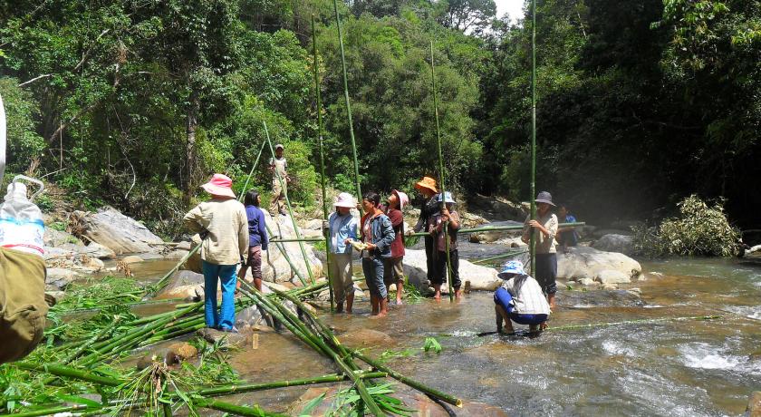
Kontum's major draw is the villages of the indigenous hill-tribes (called montagnards by the French).
It is strongly recommended to go with a guide, since he or she will be able to communicate in the minority language and keep you from inadvertently breaking taboos.
The Montagnards, has staged peaceful demonstrations in the past over land rights, the government responded forcefully. The government prefers tourists to stick to the guided tours, so as to not unduly influence or cause any problems.
If you are on a tight itinerary, it might be good to fix things beforehand, since they are often crowded with tour groups. Though some of the Bahnar villages actually form a part of Kontum's eastern and western edge, the ones farther away are more interesting. Highlights would be the different kinds of rong, the cemeteries of the Jarai and joining in a rice-wine party with the locals.
Transportation
Kontum is 246km from Buon Ma Thuot, 215km from Quy Nhon, 49km from Pleiku. National Highway No.14 runs from west of Quang Nam, vie Kontum Town, then to Gia Lai, Dak Lak, Ho Chi Minh City. National Highway No.24 connects Kontum to Quang Ngai.
Source https://en.wikipedia.org/wiki/Kon_Tum_Province
https://www.travelvietnam.com/administration-units/282-kon-tum.html
Address
Kon Tum
Vietnam
Lat: 14.661167145 - Lng: 107.838851929

